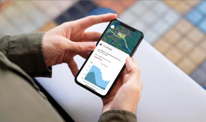
Norwegian Road Administration launches AI-driven traffic forecasting for mountain passes.
The Norwegian Public Roads Administration has introduced a new traffic forecasting feature in its Vegvesen Traffic App, designed to provide advance probability assessments for convoy driving and road closures on weather-prone mountain passes. The update aims to improve travel planning and reduce congestion and delays for drivers crossing Norway’s most challenging routes.
By integrating historical traffic and closure data with real-time weather forecasts, the system calculates percentage-based risk assessments for key mountain passes and other weather-sensitive roads. The forecasts, which extend up to a week in advance, allow drivers to make informed travel decisions, avoiding long queues and unexpected detours.
Predictive Traffic Data to Improve Travel Planning
“By using the traffic jam and closure forecast functionality as a planning tool before you travel, you can avoid being stuck in a long queue at a mountain pass or weather-prone stretch,” the Norwegian Public Roads Administration said in a statement.
Users can access these forecasts in the Vegvesen Traffic App or on vegvesen.no/trafikk, where each section is presented with a percentage-based risk of convoy driving or closure. The forecast is generated using historical traffic trends, previous closures, and the latest weather predictions.
Live Updates and Additional Features
Beyond the new predictive traffic function, the Vegvesen Traffic App provides real-time traffic reports, webcam images, and alerts for key routes, tunnels, and bridges. In-app notifications allow users to track road conditions on specific routes, while a personal inbox stores alerts for up to seven days.
“The forecasts give an indication of the likelihood of closure, but cannot guarantee that a section or mountain pass will remain open. Closures can also be due to conditions other than weather,” the Road Administration added. “Therefore, we always recommend checking the updated traffic reports in Vegvesen Traffic (online or in the app). These reports include the plowing crews’ own assessment of ‘danger to convoy,’ which gives a good picture of the situation on the road.”
Personalized Alerts and Notifications
In addition to forecasting and live updates, the app allows users to:
- View real-time traffic reports, webcams, weather stations, and electric vehicle charging points.
- Search for specific routes and receive relevant information and notifications.
- Create custom alerts by selecting and saving areas on the map.
- Store received notifications for later reference in a personal inbox.
The Norwegian Public Roads Administration encourages users to download or update the Vegvesen Traffic App to access the latest features and ensure better-informed travel planning, particularly during Norway’s unpredictable winter months.
The app also includes information on rest area toilet facilities, indicating whether they are closed for the winter and the time periods this applies to.
“We have planned to allow road owners to indicate whether a toilet facility is closed for the winter, and during which time periods this applies. Although it would ideally have been desirable to report the actual status in real time, we have considered that it is better to ensure good quality information about when the toilets are normally closed for the winter, rather than being dependent on ongoing reporting from road owners and their contractors,” Frode Kvam, Product Owner for the Norwegian Road Administration Traffic, told Norwegian outlet lastebil.no.


